IRELAND, 14 September 2022: The European Space Agency (ESA) has awarded Proveye, an Irish AgTech business that invented the use of digital image data for agricultural and environmental protection, USD 225,000 through the ARTES 4.0 Downstream Applications Demonstration Fund.
Proveye will benefit from the money by commercialising its grassland management technology, which it plans to achieve in 2023.
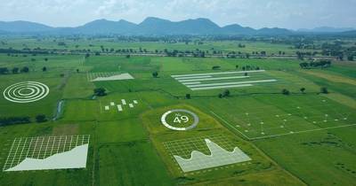
In order to provide a new generation (or a higher level) of accuracy and clarity in grassland mapping for agricultural advisors, seed suppliers, agri-input providers, commodity brokers, and government agencies, Proveye integrates Unmanned Aerial Vehicles (UAVs), satellites, and Artificial Intelligence (AI) technology into a single platform.
The grant expands on Proveye's prior collaboration with the ESA, which was successful in automating satellite image processing and analysing grassland images from unmanned aerial vehicles.
The majority of agricultural land in the world is used for growing grass, which also supports an industry worth around USD 1 trillion. Currently, it is difficult to manage grasslands with the same level of precision as it is possible for cereal crops because most farmers only traverse 5% of their farms before making management choices. Grassland advisers require digital services to effectively manage huge tracts of land because to the 150% increase in fertiliser prices over the past year and the demand on farmers and food processors to produce food more responsibly.
To map grass yield and grass quality, the Proveye grass management platform combines satellite and UAV footage utilising AI techniques. For controlling grazing, grass feed, fertilisation, and grass husbandry, real-time information on yield is essential.
Jerome O’Connell, CEO and co-founder, Proveye said “We are grateful to the European Space Agency for providing this money to help our grass management technology become more commercially viable.”
“Thanks to our platform, agri-advisors and input suppliers will be able to provide farmers with a comprehensive, almost entirely correct picture of their grasslands in virtually real-time. This will enable a farmer to see 100% of the farm area down to plant-by-plant detail, which will be a game changer in terms of productivity and sustainability of grass-based agriculture,” O’Connell added.
Image credit: dtn.com


