





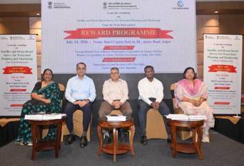


JAIPUR, 17 July 2026: The National Rainfed Area Authority (NRAA) organised a brainstorming workshop on the use of satellite and drone-based surveys for watershed planning and monitoring under the World Bank-assisted REWARD (Rejuvenating Watersheds for Agricultural Resilience through Innovative Development) programme.
Held in Jaipur, the workshop brought together officials from central and state governments, research institutions, industry and NGOs to discuss how advanced geospatial technologies can improve watershed planning, implementation and monitoring.
Welcoming participants, Dr. Susama Sudhishri, Technical Expert (Watershed Development) and REWARD Project In-charge at NRAA, outlined the workshop's objective of integrating modern technologies into watershed development programmes.
Addressing the gathering, Dr. Chandra Shekhar Kumar, Chief Executive Officer, NRAA, stressed that the upcoming National Technical Guidelines (NTG) should provide clear recommendations on the use of satellite imagery and drone surveys for watershed planning, implementation, monitoring and evaluation across different agro-climatic regions.
The workshop also featured participation from Dr. Joga Ram, Secretary and Commissioner, Panchayati Raj, Government of Rajasthan; Y.V.K. Shanmukh Kumar, Director of Watersheds, Andhra Pradesh; Kalpana Agarwal, Director, Watershed Development & Soil Conservation, Rajasthan; Dr. S. Bandyopadhyay, Director, MNCFC, Ministry of Agriculture & Farmers' Welfare; Sushila Yadav, Chief Engineer and Joint Secretary (Soil & Conservation), Government of Maharashtra, along with officials from several states, national institutes and industry.
The deliberations focused on the latest advancements and practical applications of satellite and drone technologies in watershed development. Recommendations from the workshop will help shape the National Technical Guidelines, which will serve as a key input for the upcoming Watershed Development Component of PMKSY 3.0 (WDC-PMKSY 3.0).