


NEW DELHI, 6 September 2022: RMSI Cropalytics, a Noida-based agri-tech start-up, launched the first of its kind crop map for India at the village level. The new crop map shows the geo-location of sown acreage of the current cropping season in high resolution. It is a giant leap for agriculture data visibility.
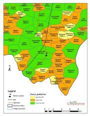
Currently, crop acreages are estimated at a coarse resolution at the state or district level but not marked or verified on the map. The first-of-its-kind crop map will be updated at the village level every Kharif and Rabi season, covering major crops such as paddy, soybean, maize, sugarcane and wheat at high resolution.
RMSI Cropalytics makes the crop map actionable by overlaying useful data on it, including village boundaries, farm sizes, crop health, weather forecasts, yield estimates and land ownership. It allows for more accurate acreage estimation by village and sharper identification of agrarian distress, as well as data-based decision-making on the deployment of resources, risk mitigation and procurement.
RMSI Cropalytics is a subsidiary of RMSI, a global consultancy with three decades of expertise in geospatial analytics, integrating earth sciences, remote sensing and climate risk modeling. RMSI works extensively in the disaster management space in India by mapping key natural hazards, including floods, cyclones and earthquakes, and is an acknowledged leader in the mapping industry. The crop map will enable multiple agri-tech applications, including remote farm monitoring, weather risk management, crop/pest detection and yield estimation, while enabling digital adoption in the agri-ecosystem.
At the launch of the crop maps, Roli Jindal, Co-Founder, RMSI Cropalytics, said, “As we celebrate 75 years of Independence, we are pleased to announce India’s first ever crop map to solve the challenges of accurate, granular and actionable data of India at scale. The crop map is the outcome of years of technical research and the application of artificial intelligence to remote images. The map will be updated every season, covering major crops, allowing for more accurate acreage estimation by village and sharper identification of agrarian distress.”
RMSI Cropalytics provide end-to-end analytics solutions to decision-makers in government, crop insurance, agri-input sector, commodity trading and social sector.
The agri-tech start-up combines new age and scalable technologies for data collection such as satellite imagery, drone technology, mobile platforms and ground-level IoT sensors to develop models based on AI/ML, using advanced forecast techniques and predictive analysis.